© inthe_mountain | Instagram

Snow Report, 14th December 2023
Well after a great start to winter here in Courchevel, we’ve had substantial amounts of rain below around 2 - 2,500 metres and wet and humid snow above in the last couple of days, however the second half of the week is looking decidedly better. Sadly the pistes below 1500m have suffered the effects of this rain and streams and rivers will struggle to cope with this amount of rain and the melt water, especially as the last few weeks has seen large amounts of precipitation.
From Wednesday onwards the weather is colder again, with the cool air coming from the north west. The freezing temperature and snowline will fall to around 1400 metres and even lower on Thursday and Friday. Around 28cm of fresh snow is forecast through Thursday with light snow showers continuing early into Friday morning. From the weekend and for a few days after there is a high pressure coming in, this will bring sunshine and clear days and it will get increasingly milder. However it will remain dry.
Into next week
Looking way ahead, so quite unpredictable at the moment, but it looks to be cooling right down again with a freezing level temperature down to around 1200 - 1400 metres and a decent snowfall forecast from Wednesday 20th for a couple of days. We’ll be able to confirm this in our report next week
Avalanche risk
The avalanche risk ranges from 3 - 4 out of 5 as large amounts of snow combined with westerly winds form slabs. Below 2200 metres the risk of wet and gliding snow avalanches will increase. This is really not the time to be heading out off-piste. By the end of the week the temperatures will have decreased again which will stabilise, refreeze and solidify the drenched slopes.
Watch Simon from White Storm Ski Rentals snow report live from Courchevel below.
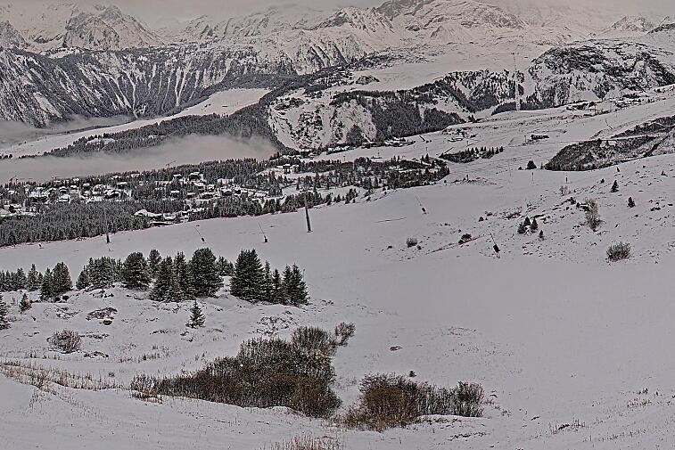
Above photo from the slopes in Courchevel this week by @inthe_mountain on Instagram.
Watch this
What do you want for Christmas?
There's still time to ask Santa for that new piece of winter gear you are missing for your ski holiday. Check out our winter clothing guide to make sure are up to date on the latest tech for your new goggles, jacket, mid-layer or whatever it is you feel you may be missing.
We're on a countdown to Christmas in Courchevel. The decorations are twinkling, Santa and reindeer outfits being dusted off and the local restaurants and bars are getting booked up for Christmas lunches and dinners. Make sure you book your table early over the festive period, check out our restaurant guide for where to eat in Courchevel.
Updates
Scroll down to see live forecasts, lift status, links to webcams and above for real time photos from Courchevel. We will be updating this snow report page every Thursday, so check back in with us next week to see how the pistes are doing and what you can expect from the snow forecast for the next seven days.
We need you!
If you're in Courchevel this week, we want to see your images, especially videos, of what you've been up to. So when you post to Facebook or Instagram, please tag us @SeeCourchevel #seecourchevel. Every week, we'll be posting our favourite videos and images here and sharing on our social media, along with our weekly resort snow report.
Look forward to seeing you out on the pistes very soon.

![[itemref] lounge](https://cdm0lfbn.cloudimg.io/v7/_images_base_/image_uploader/photos/original/2103-1-eden-20_1_21030001_1000__wwatermark1363125858_1363125858.jpg?ua=1579868553&p=carousel)