© esa.black.ski | Instagram
© ty_farm_retreat_snowdonia | Instagram


Courchevel Snow Report & Forecast
Discover the latest Courchevel snow conditions
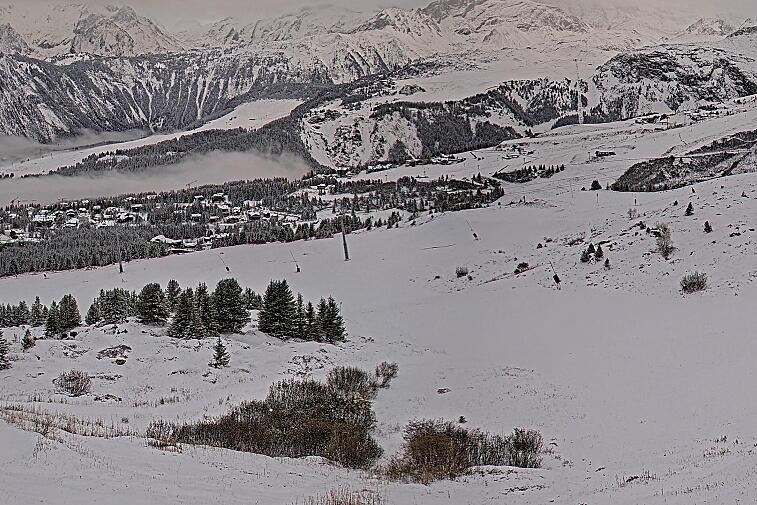
And that’s a wrap for this winter in Courchevel – and what a fantastic season it’s been! Christmas and New Year delivered major snowfall, setting us up for a brilliant holiday season that carried through into January. Regular snowfalls followed, culminating in a huge dump at the end of the month, making for incredible conditions during the school half-term holidays.
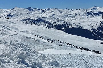
Despite some warmer spells at the start of March, the snow held up well on the lower slopes and up high it was fabulous throughout. We received frequent snow top-ups, ensuring excellent skiing right through to the end of the season this weekend.
For the last few days of the season, you’ve got quite a mixed selection of weather. It’s currently snowing hard over about 1,500m and is due to continue snowing all day, bringing up to a metre of snow in some places.
This current heavy snowfall is due to a retour d’Est; an easterly flow that typically only occurs once to three times per winter. It happens when a low-pressure system deepens over the Gulf of Genoa, creating a disturbance that draws moist air from the Mediterranean. This air is pulled in from the east by strong, counter-clockwise winds and is pushed up over the mountains. As it rises, it cools quickly and releases significant snowfall, as is happening now!
The sun will likely break through for a time on Friday, Saturday and Sunday giving some sunshine and slightly warmer temperatures to ski on all that fresh snow.
It's shaping up to be a great Easter holiday weekend and season finale, with closing day on Monday 21st April.

Top tips for skiing this week
As you've still got a few days skiing in Courchevel here are our top tips:
- the temperature is changeable in the mountains, we’re properly spring skiing now, but it may be a little chilly out of the sun. So thinner layers, a shell jacket rather than a thick winter coat, more lightweight gloves are a good idea. You will need you’ll need waterproofs for the end of this week.
- don't forget the sunscreen! Even when the windchill is high, the mountain sun is still intense.
- you’ll need your goggle lenses for cloud and sun for the next few days.
- early mornings the pistes are harder packed and maybe a bit icy and then a bit slushy in the afternoon. So coordinate your ski time to whichever conditions you prefer.
- get your skis and boards waxed as the wetter snow can slow you down a bit!
- book the restaurant terrace for a long relaxed lunch over the weekend
Check out the end-of-season parties on the slopes and in town.

Summer in Courchevel
There are many exciting events to look forward to this summer in Courchevel, check out our events calendar for more details.
Summer is a fabulous time to be in the mountains for hiking, biking, climbing and relaxing. White water rafting, lake swimming and much more. Check our website for ideas and where to stay.
Updates
If you head to the bottom of this page, you can see live forecasts, lift status, links to webcams and above for real time photos from Courchevel. Beginning again next winter season we will be updating this snow report page every Thursday, so check back in with us to see how the pistes are doing and what you can expect from the snow forecast each week.
Be social
If you are in Courchevel during the year, remember to tag us in your social posts #SeeCourchevel so we can share your pics!
Weather
Updated 25 April 2025 at 23:08


![[itemref] lounge](https://cdm0lfbn.cloudimg.io/v7/_images_base_/image_uploader/photos/original/2103-1-eden-20_1_21030001_1000__wwatermark1363125858_1363125858.jpg?ua=1579868553&p=carousel)